- Author Nora Macey macey@family-relation.com.
- Public 2023-12-16 10:17.
- Last modified 2025-01-23 08:47.
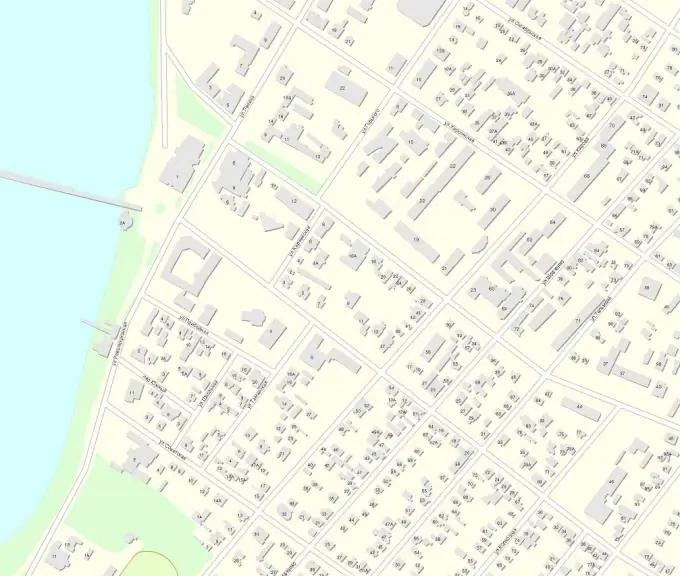
City maps can be in raster or vector form. The raster format is like a "photograph" of the map. It can be a regular topographic map of a city or an image of an electronic map. Typically, raster maps serve as the basis for creating vector maps. A vector map is the result of "digitizing" a raster; it contains information layers containing objects of the same type - coverings, buildings, roads, vegetation, etc. We will tell you about the general principle of creating a city map.

Instructions
Step 1
There are many programs for creating electronic maps of cities, including professional ones. But the process of creating any map is implemented in them in approximately the same way. Initially, you need a raster subframe. It can be a fixed-scale topographic map of a city, but even better if it is a satellite image, since the topographic maps of the cities on the market have not been updated for a long time. Good quality satellite imagery can be taken from GoogleMaps.
Step 2
The raster image must be scaled, i.e. "Tie" it to flat geodetic or geographic coordinates. This will allow you to correlate the distances between the points on the image, marked with the cursor, with the actual distance on the ground. Scaling allows you to determine linear dimensions with a high degree of accuracy.
Step 3
By the scaled raster it is already possible to digitize objects. Digitization, or vectorization, means drawing the contour of an object by its nodal points. Objects can be both contour - buildings, coatings, reservoirs, and linear - paths, railways. There are also point objects - memorials and monuments, boiler pipes. Each object must have its own information layer.
Step 4
Decide what information layers you want to see on your map. For a city map, the minimum required set of information layers will be small: buildings with numbering, streets with names, vegetation, railways, water objects.
Step 5
You will have to digitize each information layer separately. To clarify the building numbers and street names, you will need to go to the place or use any other additional information. By combining all information layers, you can get a vector map of the city, which can be printed at the required scale or work with it in various geoinformation programs.


